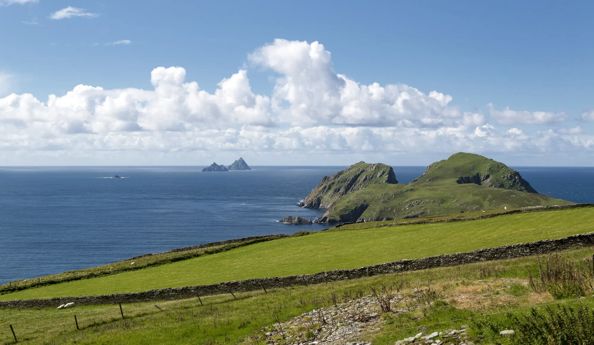
The Wild Atlantic Way in 7 Days
A realistic seven-day Wild Atlantic Way itinerary from Galway to the Skellig coast, with honest driving times, where to sleep each night, and what to skip.
- Days
- 7
- Distance
- 900 km
- Getting around
- Car
- Best months
- May to September
- Route
- Galway City → Skellig Michael
Your route at a glance
Seven sightseeing days, seven nights, four bases: Galway for two nights, Doolin for one, Dingle for two and Portmagee for two. Leave on day eight. This covers a section of the Wild Atlantic Way, not its entire length. The airport approach and departure transfer sit outside the route below.
Want to finish where you started? Choose the ten-day Shannon loop. Prefer someone else to do the driving? Our week without a car uses two city bases and guided countryside days.
Distances are rounded planning estimates for the suggested roads and local detours, not measured navigation instructions. Driving allowances exclude meals and visits; ferry time is shown separately. Allow roughly 800–950 km before airport transfers, depending on detours.
| Day | The plan | Sleep in | Travel |
|---|---|---|---|
| 1 | Galway on foot | Galway | Local walking; add your airport transfer |
| 2 | Connemara and Kylemore loop | Galway | Around 200 km · 4–5 hr driving |
| 3 | Burren coast and Cliffs of Moher | Doolin | 100–130 km · 2–3 hr driving |
| 4 | Kilkee and Shannon ferry to Dingle | Dingle | 180–210 km · 3–4 hr driving + ferry and wait |
| 5 | Slea Head clockwise | Dingle | 50–70 km · 1.5–2 hr driving |
| 6 | Killarney lakes to the Skellig coast | Portmagee | 230–260 km · 4–5 hr driving |
| 7 | Skellig boat or a local coast day | Portmagee | 0–30 km locally; reserve the day for the boat |
What to budget
For two adults sharing a room, an illustrative seven-night budget is €2,365–€3,985, before flights and a Skellig landing. These are planning allowances, not live hotel or car-hire quotes:
- Rooms: €140–€220 per night, or €980–€1,540 for seven nights.
- Car hire: allow €350–€700, then check the actual insurance, deposit, automatic transmission and one-way return conditions.
- Fuel, parking and road costs: €150–€220, plus approximately €25 for the Shannon ferry. The operator lists cars including passengers from €22.50 online, checked 22 September 2026.
- Food: €90–€150 per day for two, or €630–€1,050 for seven days.
- Other admissions and activities: €230–€450 for two.
A Skellig landing operator currently advertises €145 per person before booking fees. Budget another €290 for two, plus those fees, if landing is the priority. Reprice the whole trip for your dates; festivals and peak-season rooms can exceed these allowances.
Book in this order
- Match flights to the route and compare the full car-hire quote, including any charge for returning it at a different airport.
- If landing on Skellig Michael matters, check a permitted operator's availability, eligibility and cancellation terms before fixing the week.
- Reserve Galway × 2, Doolin × 1, Dingle × 2 and Portmagee × 2 nights. Choose walkable locations and confirm parking.
- Book any timed attractions or cruise you want, leaving a weather alternative. Confirm whether a boat ticket is for landing or cruising.
- Recheck ferry sailings, coastal-path closures and boat instructions shortly before travel. Keep the flight home off the Skellig day.
Check before you travel
Full itinerary: https://irishtravelguide.com/journeys/wild-atlantic-way-7-days/
Land in Galway, not in Dublin
Most Wild Atlantic Way itineraries waste their first day driving out of Dublin. Fly into Shannon instead if the routes work for you. It is ninety minutes from Galway rather than three hours, and it puts you on the coast by lunchtime on day one.
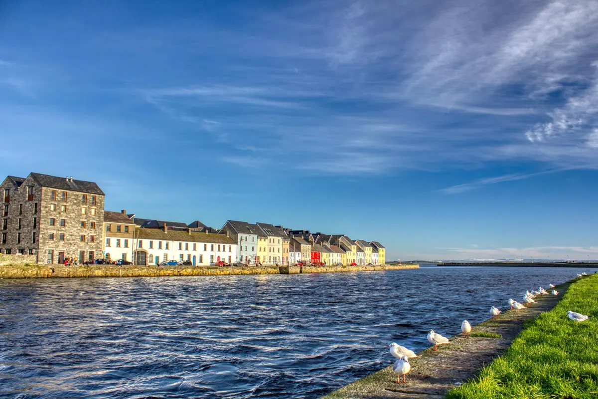
Galway is small enough to walk in an afternoon and dense enough that you never quite finish it. Start at the Spanish Arch, work up Quay Street while the buskers are still setting up, and let the Latin Quarter take care of the rest. If you are here on a Saturday, the market behind St Nicholas' Church is the one fixed point worth planning around.
Do not try to add Connemara today. You will have been travelling since dawn, the light will be going, and Connemara is worth more than a tired drive-through. Eat early, find a session at Tigh Neachtain or The Crane, and go to bed. Tomorrow is the long one.
If you have to fly into Dublin and want the capital as well as the coast, this is the wrong week: Ireland in Seven Days loops out of Dublin and takes in Cork and Kerry instead of giving the whole week to the west.
On this stretch Galway City
Connemara, and the abbey everyone photographs
The N59 out of Galway turns from ordinary to extraordinary somewhere around Maam Cross. By Recess you are among the Twelve Bens with bog stretching out on both sides in colours that never photograph properly: rust, ochre, black water.
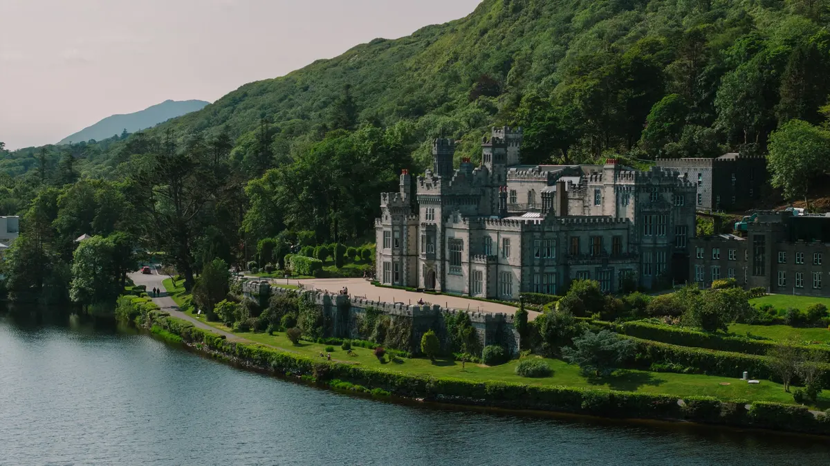
Kylemore Abbey is the picture you have already seen, a Victorian castle mirrored in a lake under a mountain. It is lovely and it is busy. Check the abbey's opening and admission details and leave time for the walled garden rather than only the lakeside view.
Continue towards Clifden, with the Sky Road as an optional detour if the weather and remaining daylight suit. A coastal return through Roundstone is another choice; do not assume every detour fits around a long abbey visit.
Back in Galway for dinner. Allow around 200 km before extra detours and four to five hours driving, with visits and meals on top. This needs a full day; choose a more direct return if you want longer at Kylemore.
On this stretch Kylemore Abbey · Clifden
See the Cliffs of Moher from the water
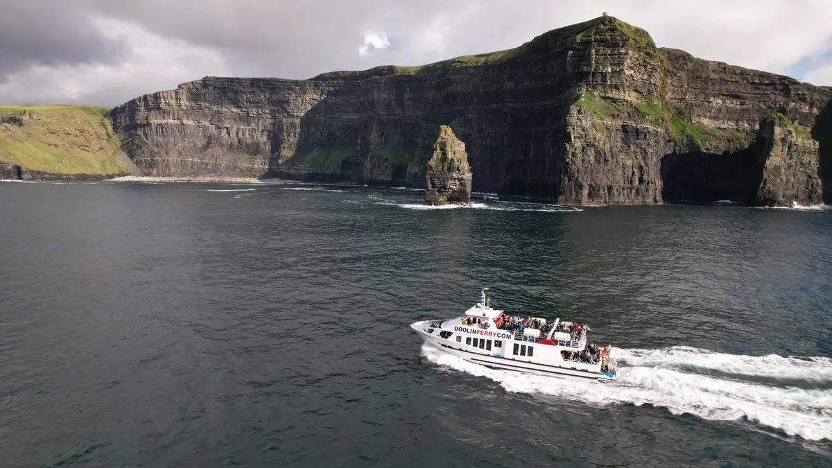
The best advice in this itinerary is one sentence long. Take the boat from Doolin.
Almost everyone drives to the visitor centre, walks the fenced path, looks down and leaves. From the water you look up at 214 metres of black shale with puffins coming off it, and you see the sea stack and the caves that are invisible from the top. Check the operator's seasonal timetable and fare before choosing a sailing; the cruise is an extra paid activity.
Get there through the Burren on the R477 Coast Road. It is a limestone landscape of exposed rock and low walls. Poulnabrone dolmen is inland on the R480, not on the coast road: allow a separate detour if you want to see it rather than trying to fit every Burren stop before the boat.
If the boat is cancelled, use the designated paths at the Cliffs of Moher Experience, subject to its opening and weather advice. As checked in September 2026, the coastal walk does not connect Doolin to the visitor centre and the southern route to Hags Head is closed. Read the official access notice before setting off. Sleep in Doolin and choose a room within walking distance of dinner: the village is spread out, so check the address.
On this stretch The Burren · Doolin · Cliffs of Moher
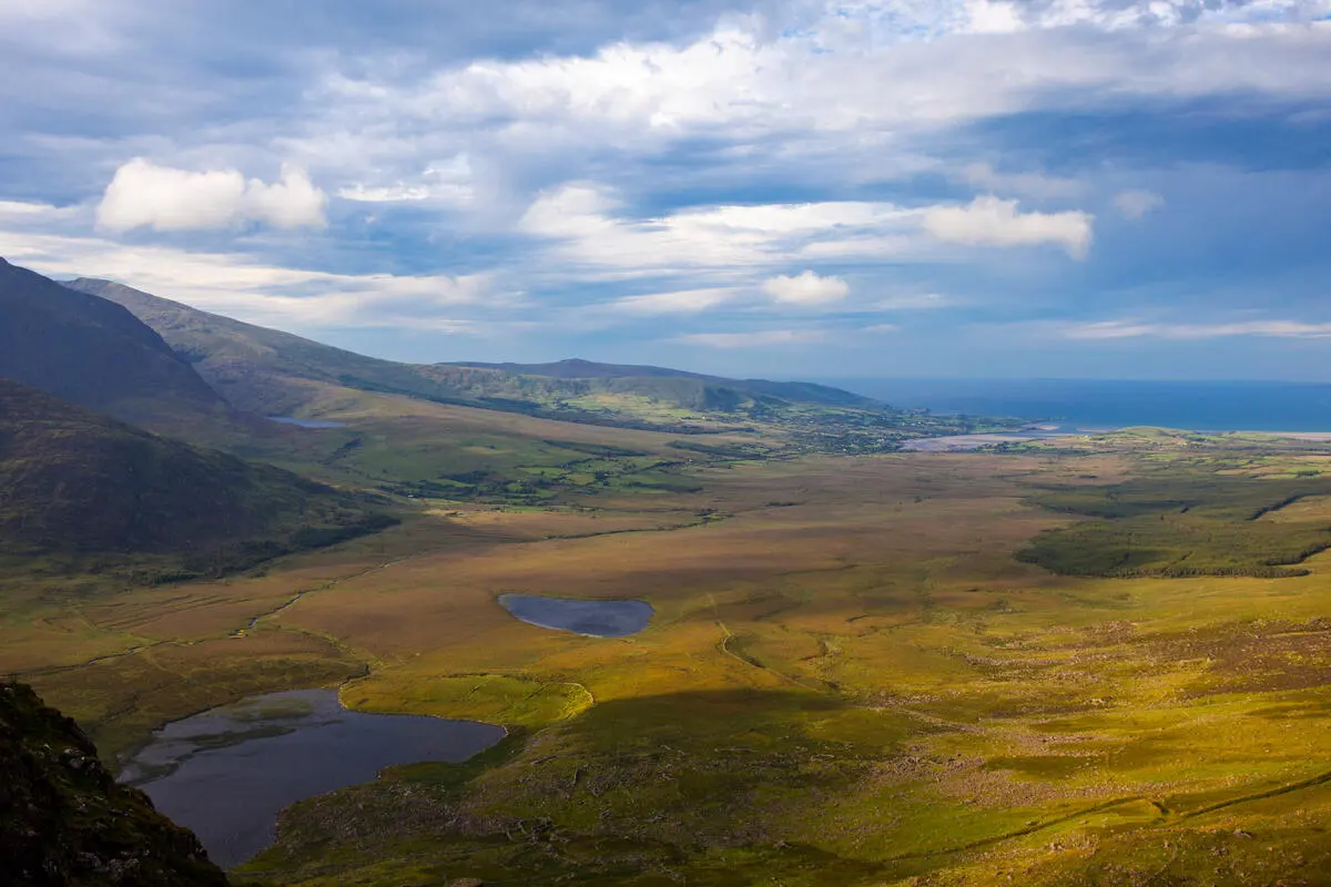
The ferry south, and the road into Dingle
Take the Killimer to Tarbert ferry across the Shannon. The crossing takes about 20 minutes, but allow time for the queue and the next sailing. You can buy a ticket online; that is different from reserving a place on a specific departure. Check Shannon Ferries for the timetable for your month and current vehicle fares. The time saved against driving through Limerick depends on the wait, not just the map.
Kilkee is the manageable coastal stop today. A trip all the way to Loop Head lighthouse adds a substantial detour: allow at least another ninety minutes for driving and a short stop, or leave it for a longer Clare stay. You still have Kerry to reach after the ferry.
South of the ferry the country softens into farmland, then rears up again around the Dingle Peninsula. Use the N86 into Dingle for the simpler approach. Conor Pass is an optional mountain route, with narrow sections and vehicle restrictions; leave it out in poor visibility or if you are still getting used to the hire car.
Dingle town is a working fishing port that happens to have very good food and more pubs than its population justifies.
On this stretch Kilkee · Dingle
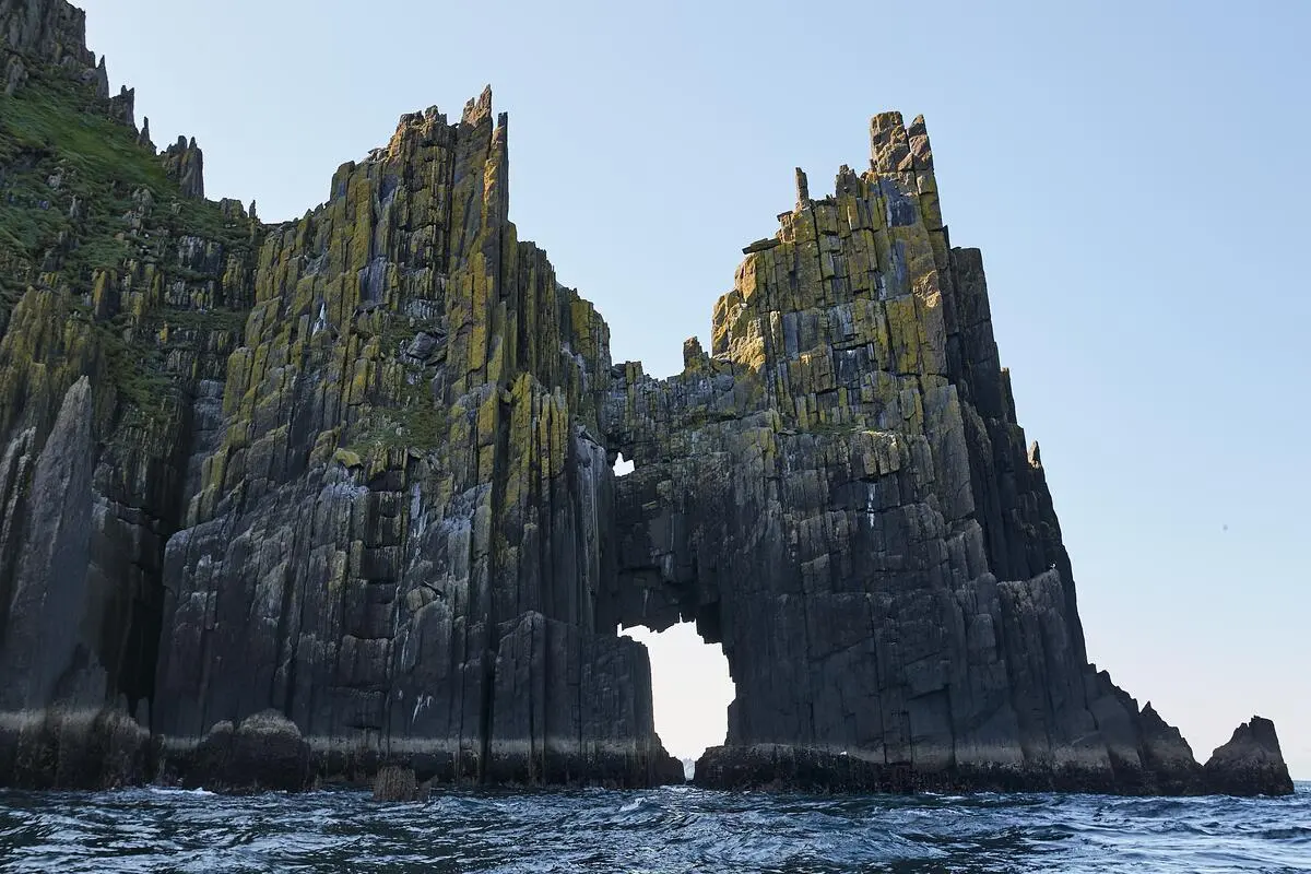
Europe ends here
The Slea Head Drive is a 47 km loop and it deserves a whole day rather than a morning. Follow the local visitor guidance and drive clockwise through Ventry. Do not reverse the circuit to try to dodge coaches; leave room for local traffic and use signed parking.
Stop at the beehive huts, at Dunbeg fort, and at the Gallarus Oratory, a dry stone chapel that has kept the rain out for twelve hundred years without a drop of mortar. Then at Slea Head itself, where the land stops and the Blasket Islands sit out in the swell. People lived out there until 1953, and the visitor centre at Dunquin tells that story better than it needs to.
This is the westernmost inhabited point of the country and one of the strongest Gaeltacht areas left. The road signs stop being bilingual and the radio changes language.
Back to Dingle for the evening. If the day has been kind, walk out to the lighthouse at dusk.
On this stretch Slea Head · Blasket Islands viewpoint
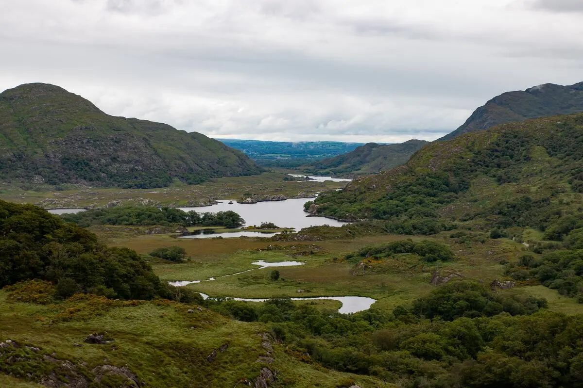
Across the Kerry lakes to Portmagee
This is the longest driving day: leave Dingle after breakfast and follow the N86 and N72 towards Killarney. Choose one short park stop, such as Torc Waterfall, rather than trying to fit in a house tour and a lake cruise before crossing the mountains. Allow four to five hours behind the wheel over the whole day, with visits and lunch on top.
Take the N71 past Ladies View and Moll's Gap, then pause in Kenmare. Continue on the N70 through Sneem and Waterville towards the Skellig coast. This is the southern part of the Ring of Kerry, not a complete circuit. Trying to close the loop would undo the point of ending near tomorrow's boat departure.
Sleep in Portmagee tonight. The old temptation is to return to Kenmare for dinner, then drive west again early for the Skellig boat. Staying by the harbour removes that extra transfer. Confirm the pier and reporting time with your operator before choosing your accommodation.
If a full park day matters more than a boat landing, stop in Killarney instead and drop the Skellig day. The ten-day Shannon loop gives the lakes more breathing room without fitting both into one afternoon.
On this stretch Killarney National Park · Kenmare · Portmagee
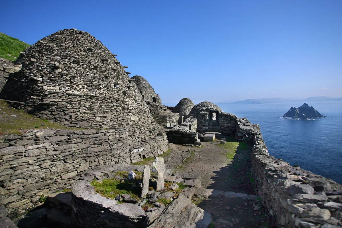
Out to the Skelligs, if the sea allows
Skellig Michael is the reason to keep day seven flexible. It is a monastery on a pyramid of rock out in the Atlantic. The climb involves 618 steep, uneven steps and is not suitable for every visitor. Check the OPW visitor guidance and permitted operators before booking. Its published 2026 season is 12 May to September, subject to change; children under 12 are not permitted.
Book the landing tour months ahead and treat it as a lottery ticket. If it sails, it will be the thing you remember from the whole trip. If it does not, ask the operator whether a non-landing cruise is running and suits the conditions. A cruise is a different booking, and it can be cancelled by weather too. Do not assume it is a guaranteed backup.
The weather-beaten plan B is the Kerry Cliffs at Portmagee, ten minutes away, which are arguably a better cliff view than Moher.
Keep the night after the boat in Portmagee and leave the airport transfer for the following day. This is seven sightseeing days and seven nights, with departure on day eight. Check flights and one-way car-hire charges before choosing Kerry, Cork or Shannon for the journey home.
On this stretch Portmagee · Skellig Michael
Questions people actually ask
Is seven days enough for the Wild Atlantic Way?
Not for the whole route, which runs 2,500 km from Donegal to Cork and needs about two weeks. Seven days is enough for one very good section, and Galway to Kerry is the strongest of them: the Cliffs of Moher, Connemara, Dingle and the Ring of Kerry in one continuous drive.
Which direction should I drive the Wild Atlantic Way?
This guide travels south from Galway to Kerry because that fits its overnight stops and finishes near the Skellig boats. Either direction can work. Ireland drives on the left: choose safe signed parking rather than assuming coastal viewpoints will be on your side of the road.
Do I need a car?
This exact route assumes a car. Public transport and organised tours reach parts of these regions, but do not reproduce all these stops on the same schedule. Our separate seven-day Ireland without a car guide uses Dublin and Galway as bases, with organised trips into the west.
When is the best time to drive it?
May, June and September are our preferred balance of daylight and pace. Weather can disrupt plans in any month. Check the published Skellig landing season for your year before making the boat the centre of the trip.
How much driving is it each day?
The driving days range from roughly one to five hours, excluding visits, with the longest transfer on day six. The overview lists each day's allowance. Day one assumes arrival in Galway; the airport approach and the transfer home after day seven need additional time.
Last checked